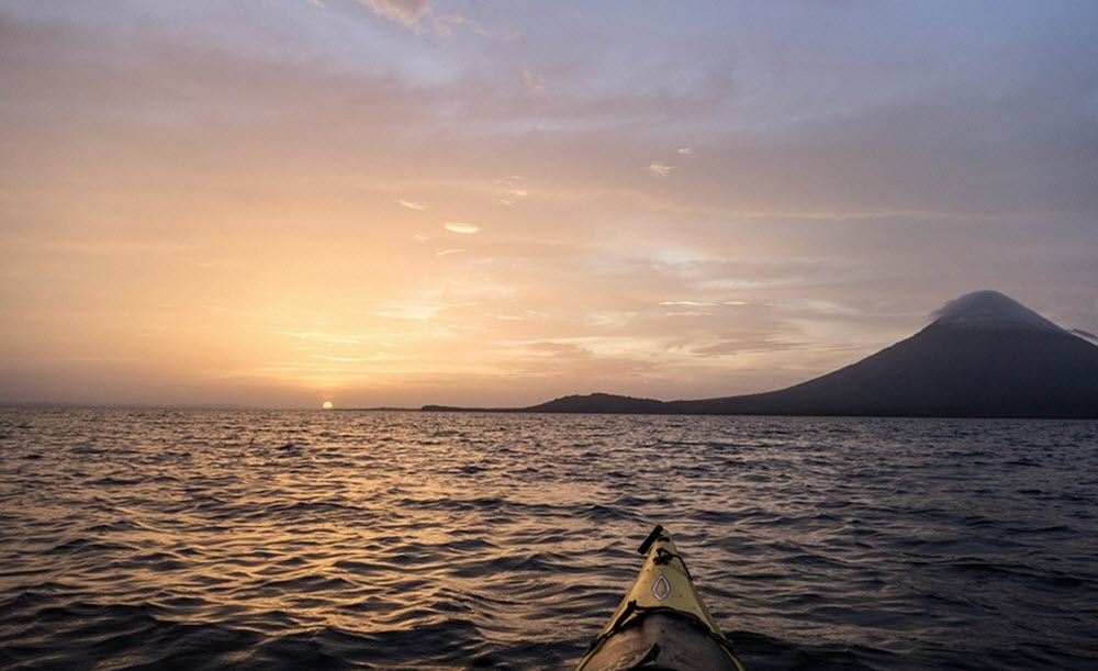
Lake Nicaragua – Lago Cocibolca

Lake Nicaragua, also known as Cocibolca, is a large freshwater lake in Nicaragua. It covers 8,264 square kilometres and is the largest freshwater lake in Central America, and the 10th largest in the Americas.
Names
This lake is known under several different names, including Lake Nicaragua in English and Lago de Nicaragua in Spanish.
In Nicaragua, it is also named Cocibolca, which is an indigenous name that means “sweet sea”. The reference to this big lake being a sea can also be seen in the Spanish nickname Mar Dulce (Sweet Sea).
Due to its size, the lake is sometimes simply called Gran Lago (Big Lake) and Gan Lago Dulce (Big Sweet Lake) in Nicaragua.
Since the largest and historically most important city along its shore is Granada, the lake is also known as Lago de Granada (Lake of Granada).

Short facts about Lake Nicaragua
- The lake is 161 km long.
- At its widest point, it is 71 km wide.
- The lake´s surface is less than 33 metres above sea level.
- The max depth is circa 26 metres, while the average depth is around 13.3 metres.
Inflows and outflows
Lake Nicaragua has 40+ inflows, with one of the most famous ones being Río Tipitapa, a short river that connects Lake Nicaragua with Lake Managua (Xolotlán). Lake Managua is situated at a higher altitude than Lake Nicaragua (although the difference is only around 10 metres) and during times of high water levels water from Lake Managua will flow into Lake Nicaragua.
The primary outflow of Lake Nicaragua is Río San Juan, which is a 192 kilometre long river running from Lake Nicaragua to the Caribbean Sea. The southern bank of this river constitutes a large part of the border between Nicaragua and its southern neighboor Costa Rica.
Historically, the connection that Río San Juan forms between the Atlantic side of Central America and the big lakes Cocibolca and Xolotlán, which are both found in western Nicaragua, was very important for trade and transport. Boats would travel all the way from the Atlantic side to the westernmost rim of Cocibolca, where only a fairly short passage over land is required to reach the Pacific Ocean. This connection between the Caribbean and Lake Nicaragua also meant that Granada, once the colonial capital of Spanish Nicaragua, was technically an Atlantic port, even though it is much closer to the Pacific Ocean.
Islands
Lake Nicaragua is home to over 400 islands and islets, including Omotepe, Zapatera, the Islets of Granada, and the Solentiname Islands.
Settlements
Examples of notable towns and settlements in and around Lake Nicaragua are Granada (on the lake´s north-western shore), San Jorge (also on the lake´s western shore, has a ferry connection to Ometepe) Moyogalpa (on Ometepe), Altagracia (on Ometepe), and San Carlos (at the confluence of south-eastern Lake Nicaragua and the San Juan River).
Ometepe – a unique double volcano island in Lake Nicaragua
Ometepe is something truly remarkable – an island formed by not one but two volcanic craters raising out of a huge freshwater lake. The two craters are named Concepción and Maderas, and are joined together by an isthmus to form one island.
The name Ometepe comes from the Nahuatl words ome (which means two) and tepetl (which means mountain). It is thus a reference to the two volcanoes. The first known inhabitants of Ometepe spoke Macro-Chibchan languages and left evidence of their lives here in the form of petroglyphs and stone idols on the northern slopes of Maderas. The oldest of these artefacts have been dated to circa 300 BC. Other petroglyphs on Ometepe are several centuries younger and were carved by Chorotega and Nicarao peoples, who also created statues from basalt rock.
A land area of 276 square kilometres makes Ometepe the largest of all the islands in Lake Nicaragua. The two main villages are Altagracia on the north-eastern side of the island and Moyogalpa on the north-western side.
The volcanic ash makes the island very fertile and the local economy is largely based on agriculture (especially plantains) and livestock, although tourism has increased in the 21st century, including eco tourism and archaeological tourism.
Concepción
Concepción is the tallest of the two volcanoes, with its impressive symmetrical cone reaching an altitude of 1,610 metres. After a long period of dormacy, Concepción woke up again, with an eruption taking place on December 8, 1880. More eruptions followed in both the 19th, 20th and 21st century.
Maderas
Maderas constitute the south-eastern part of Ometepe and is 1,394 metres above sea level. It is dormant and home to a crater lake. Nowadays, its slopes are covered in lush cloud forest, and there are also farmers growing coffee and tobacco here. Much of this part of Ometepe is protected as a nature reserve.


